
Hiking the Río Santa María
Hiking the Río Santa María: Canyons, Trails, and a River We Know Intimately
The Río Santa María is one of the most powerful and beautiful rivers in central Mexico. From its birth in the mountains of San Luis Potosí to the point where its name disappears at the Cascada de Tamul in the Huasteca Potosina, the river carves deep canyons, feeds remote communities, and creates some of the most challenging and rewarding routes in the Sierra Gorda.
Along its entire course, it would be hard to find someone who knows this river better. Our hikes and canyon routes follow the Río Santa María through its wildest sections, offering experiences that range from challenging day hikes to multi-day expeditions deep in remote canyon country.
A River of Constant Change
The Río Santa María is defined by contrasts—wide turquoise pools followed by narrow canyon corridors, calm walking sections interrupted by technical obstacles, and quiet campsites tucked beneath towering canyon walls. Water levels, seasons, and terrain all play a critical role in when and how these routes can be explored, making local knowledge essential.
La Laja to El Platanal (Xichú, Guanajuato)
This off-the-beaten-path hike follows the river from La Laja to El Platanal, passing through the dramatic Canyon of the Ojo de Agua. The route combines river walking, canyon scenery, and remote terrain rarely visited by outsiders.
Difficulty: Intermediate
Best season: October–December, just after the rainy season
Ideal for: Hikers looking to test themselves and see if they’re ready for more demanding adventures
This hike is a perfect stepping stone for those wanting to move beyond classic Sierra Gorda routes.
Los Tres Estados
Downriver from El Platanal lies one of the most remote sections of the Río Santa María—Los Tres Estados, where San Luis Potosí, Guanajuato, and Querétaro meet. The terrain here is extremely demanding, with rugged canyon walls, difficult river crossings, and some of the most spectacular campsites along the river.
Duration: 2–5 days
Difficulty: Very strenuous
Best season: October–December
Only very fit and experienced hikers should attempt these routes, which represent some of the wildest terrain in the region.
Canyon of the Jaguars
The Canyon of the Jaguars is one of the most technical and committing sections of the Río Santa María. This route is a mix of swimming and hiking, weaving through narrow canyon corridors and massive rock formations.
Duration: About 1.5 days (possible in one long day, but best enjoyed at a slower pace)
Best season: March–May
Important: This canyon should never be attempted without a guide
There are three critical choke points in the canyon where hikers must find safe routes around large rapids and enormous boulders. People sometimes reach these sections and cannot find a safe passage, forcing them to turn back upstream. Experience and route-finding knowledge are essential here.
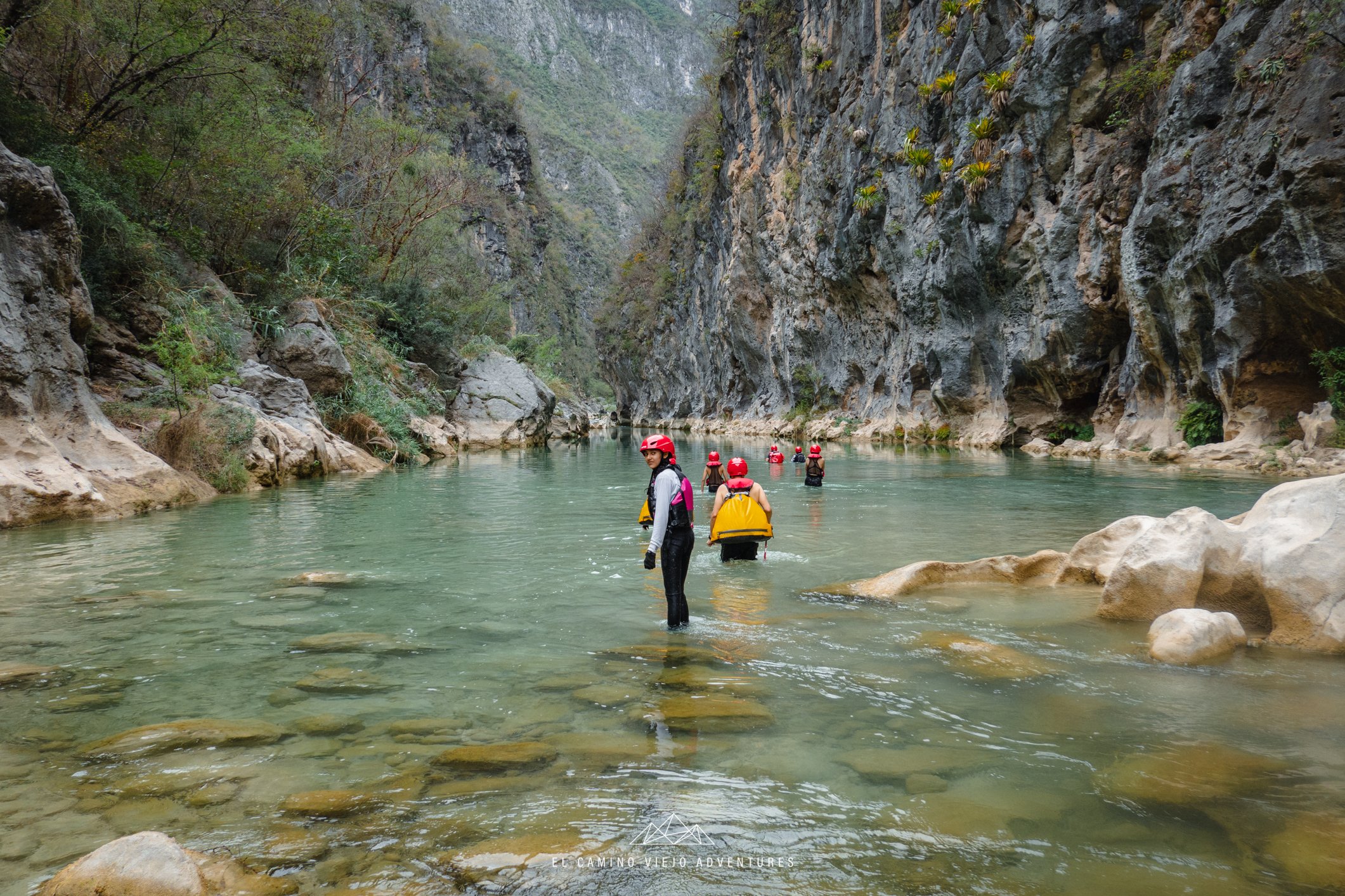
El Camino del Pame
Our most popular hike, El Camino del Pame, follows the Río Santa María between the Canyon of the Jaguars and our Amazona route. This ancestral trail was once used by the Pame people and combines cultural history with outstanding river scenery.
The route features turquoise pools, limestone formations, jungle-lined riverbanks, and long walkable stretches of river, making it both scenic and deeply immersive.
Difficulty: Moderate
Best season: October–April
Why it stands out: A perfect balance of history, beauty, and accessibility
For many hikers, El Camino del Pame is their introduction to the Río Santa María—and often the route that leaves the strongest impression.
Amazona Canyon
Downriver from El Camino del Pame lies Amazona, our favorite canyon along the Río Santa María. This remote canyon takes 2–3 days to complete and, like the Canyon of the Jaguars, should only be attempted with a guide.
Difficulty: Very demanding
Best season: March–May
Amazona offers long swims, narrow canyon walls, dramatic light, and total immersion in one of the wildest sections of the river.
Cascada de Tamul: Where the River Changes Name
The Cascada de Tamul marks the final stretch of the Río Santa María, where the river plunges dramatically and becomes part of the Huasteca Potosina landscape. Here, the river’s turquoise waters drop over Mexico’s tallest waterfall in San Luis Potosí before continuing under a different name.
While very different from the remote canyon routes upstream, Tamul is a powerful reminder of how far the Río Santa María has traveled—and how much it shapes the land along its journey.
Want to Explore the Río Santa María?
From challenging day hikes to multi-day canyon expeditions, our routes along the Río Santa María are designed for those who want to go beyond the usual trails and truly understand the river. If you’d like more information or want to plan an adventure based on your experience level and the season, feel free to contact me.
📞 WhatsApp / Phone: +52 441 203 9677
Derek Larson
El Camino Viejo Adventures